By Graham Ashford
There is a particular feeling that comes at the southern edge of Carmel, where the cottages give way to Carmel Meadows and the road bends toward Point Lobos, and the whole of the Big Sur coast waits somewhere beyond the next headland. For nearly three years, that feeling carried an asterisk. You could drive south, but only so far. The road — the most celebrated stretch of pavement in California, perhaps in America — was broken in the middle, and every journey down it ended in a turnaround.
Not anymore. In January 2026, Caltrans reopened the final closed section of Highway 1 at Regent’s Slide, nearly ninety days ahead of schedule, and for the first time since early 2024 the entire coast road runs unbroken from Carmel to Cambria and beyond. The engineering behind that quiet triumph is worth pausing over: crews drilled and grouted more than 4,600 steel bars — some of them sixty feet long — into the unstable hillside in a ten-by-ten-foot grid, stitching the mountain to itself. It is a remarkable thing, when you think about it, that a road this beautiful survives at all. The Santa Lucia Range wants very much to slide into the sea, and every year a small army of people persuades it not to.
Which means this summer carries a rare distinction: it is the first full season in almost three years that you can drive the whole thing. Not a segment. Not an out-and-back. The whole coast, again.
Leaving the Peninsula
The drive from Carmel to Cambria covers roughly ninety-five miles, and the arithmetic of it is deceptive. A determined driver can do it in two and a half hours; no one should. Give it a day. Leave in the morning, when the fog still holds the coast in soft focus, and let the road decide your schedule.
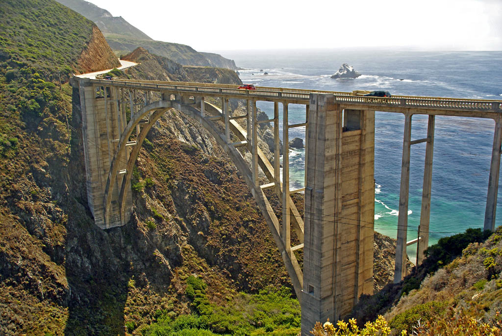
South of Point Lobos, the landscape opens almost immediately — Garrapata’s granite coves, the long lupine slopes above Soberanes Point — and then, about thirteen miles out of Carmel, the road delivers its first icon. Bixby Creek Bridge, completed in 1932, remains the most photographed object on this coast for good reason: a single concrete arch flung 260 feet above the creek mouth, as confident a gesture as American engineering ever made. Stop, yes. But go early or go late; by midday in summer the turnouts fill, and Bixby is best met with a little solitude.
From there the road climbs to Hurricane Point, drops to the Little Sur River, and runs past the long crescent of Andrew Molera before entering the redwood shade of the Big Sur Valley — the gentle, wooded interlude before the coast turns operatic again.
The Heart of the Coast
Every journey down this road should include a pause at Nepenthe, and not merely for the view, though the view — eight hundred feet above the Pacific, the coast unspooling south toward infinity — has been stopping conversation since 1949. That was the year Bill and Lolly Fassett opened their terrace restaurant on a piece of land they had purchased from Orson Welles and Rita Hayworth, whose plans for a honeymoon hideaway never quite materialized. The building itself, designed by Frank Lloyd Wright protégé Rowan Maiden, still feels less like a restaurant than a gathering place that happens to serve lunch. Henry Miller was a regular in the early years, and something of that bohemian ease lingers on the terrace still.
Miller himself is honored a half mile down the road, at the Henry Miller Memorial Library — a small cabin among the redwoods that functions as bookstore, arts center, and unofficial living room of literary Big Sur. If the gate is open, go in. Browse. Linger. It is the kind of place that rewards the traveler who is not in a hurry, which is to say it is the distillation of Big Sur itself.
South of the valley, the road enters its grandest and loneliest stretch — past the flanks of Partington Ridge, past McWay Falls dropping its white ribbon onto the sand at Julia Pfeiffer Burns, past Esalen’s cliffside gardens and the arched span at Big Creek. This is the section the slides kept closing, and driving it now, whole and open, you understand what was missing. There is a rhythm to the full coast road — climb, curve, reveal; climb, curve, reveal — that no partial drive can reproduce. Somewhere south of Lucia, with the mountains falling two thousand feet straight into a silver sea, you stop measuring progress altogether.
Arrival
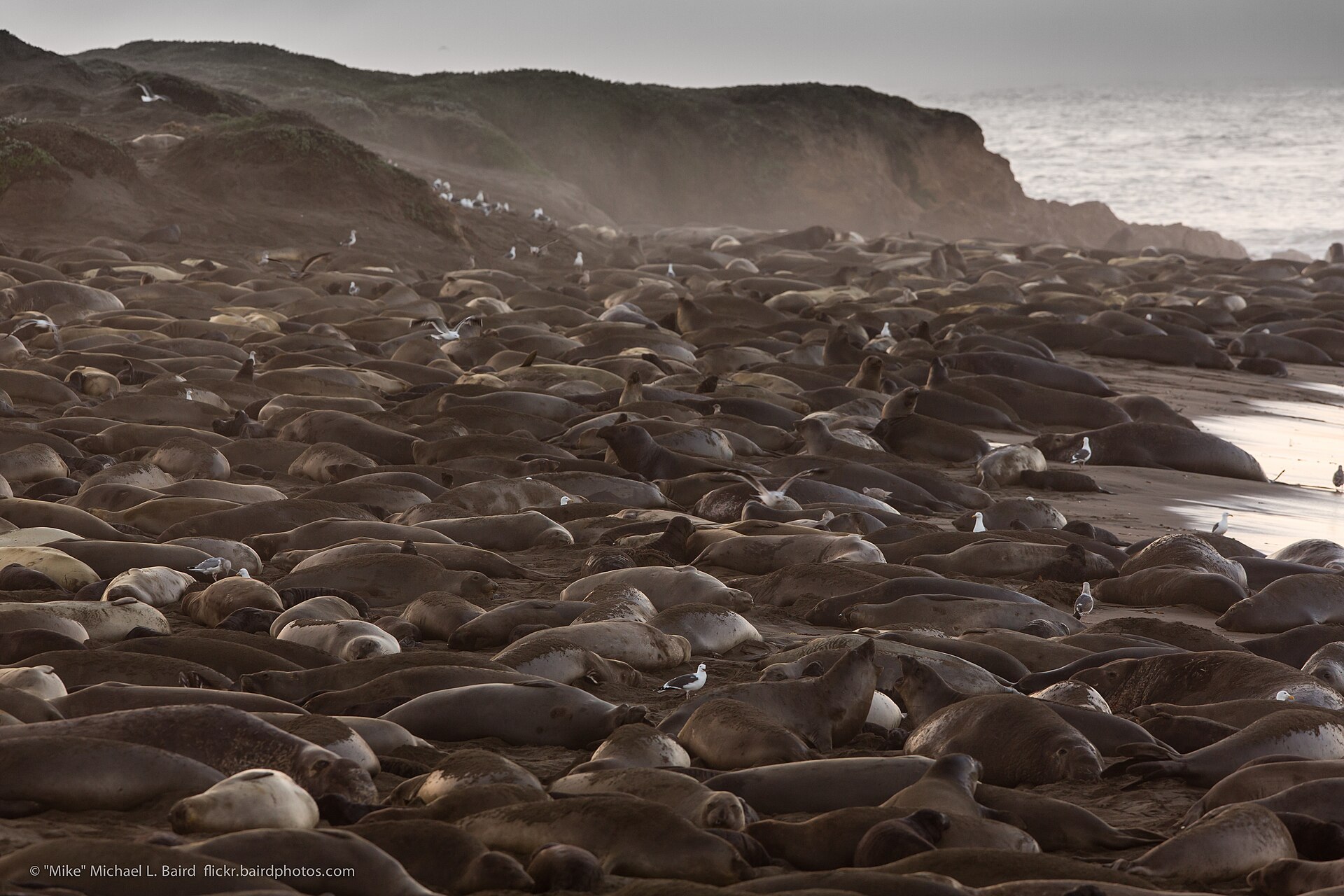
The southern miles announce themselves gradually. At Ragged Point, the cliffs make one last dramatic stand — the promontory here is often called the gateway to Big Sur, though southbound it feels more like the coast’s final flourish — and then the land relaxes into the golden marine terraces of San Simeon. Watch for the turnout at Piedras Blancas, where elephant seals haul out on the beach in their hundreds, indifferent to their audience, and for the distant silhouette of Hearst Castle on its enchanted hill.
And then, almost suddenly, Cambria: a village tucked into a forest of Monterey pines, one of the few native stands of that tree anywhere in the world. It is the right place to end this drive — a town that, like Carmel, grew up among the pines and never entirely left its village self behind. Walk the boardwalk at Moonstone Beach as the light goes long over the water, find a glass of local wine in the East Village, and consider the satisfying symmetry of the day: you began in one pine-shaded seaside village and ended in another, with ninety-five of the most beautiful miles on Earth in between.
Grace notes
The season: Summer brings reliable roads and morning fog that usually lifts by noon; September and October offer the clearest skies of the year. Whatever the month, check current conditions before you go — the Big Sur Chamber of Commerce and Caltrans both keep updated reports, and routine maintenance can mean brief one-way controls along the route.
The direction: Driving south puts you in the ocean-side lane, with the turnouts on your side of the road. Save the northbound return for another day — the coast is an entirely different drive in reverse.
The tank and the table: Fill up before leaving Carmel; fuel in Big Sur is scarce and priced accordingly. Book lunch loosely — Nepenthe takes no reservations for the terrace, and the wait is part of the ritual. Better to hold your firm booking for dinner in Cambria.
The pace: Ninety-five miles, one full day. The road has waited three years to be whole again. It seems only fair to give it your whole attention in return.